Pro Building, Not Rebuilding

The East River Blueway Plan establishes community-based framework for East River waterfront
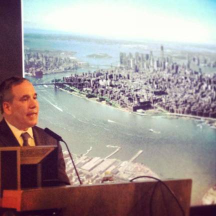
"The water is coming," said Eric Klinenberg to community members and elected officials gathered at Cooper Union last week. Klinenberg, an NYU professor and author to one of the most famous essays about rebuilding New York City after Hurricane Sandy, went on to say there's not much we can do about that fact anymore.
Indeed, the crowd was there to discuss proactive ways to rebuild the City in anticipation of rising sea levels, in particular the East River Blueway Plan, commissioned by Borough President Scott Stringer and Assembly Member Brian Kavanagh in collaboration with community boards in the area and the Lower East Side Ecology Center. The plan itself has been more than a year in development.
"The important thing to do is reduce greenhouse gases, but we also need to think about how to adapt and build our cities differently," explained Klinenberg. "Our impulse is to rebuild, but after Sandy the new challenge is to pro-build."
"We cannot go back to what we had before," he added. "We have to build in anticipation of what's coming next time."
At the risk of sounding alarmist, Klinenberg made a comparison to rebuilding the City after 9/11 and talked about developing "dual use homeland security strategies."
"We have a sense we need those [security strategies] but they haven't made the City more pleasant," he said. "We put up with them because we feel like we have to. Our systems do not have to be unpleasant."
Klinenberg and others who presented at Cooper Union talked about seeing the waterfront as an opportunity-a way to prevent storm surges but also enhance the quality of everyday life in the community. The Blueway Plan covers the East River waterfront from the Brooklyn Bridge to East 38th Street, affecting the South Street neighborhood area, the East River Park waterfront and the Stuyvesant Cove waterfront plaza, as shaped predominantly by FDR Drive, though presenters discussed the importance of viewing the plan in conjunction with the entire coastal region.
The East River Blueway Plan is a social infrastructure, they explained, as well as a system intended to curb the impact of disasters. It's also a springboard for the future.
"This plan is a model for initiatives to come," said Roland Lewis, president and CEO of the Metropolitan Waterfront Alliance. "Our waterfront is a utility-it's owned by thousands of folks and entities, but we all depend on the utility."
He added the Blueway plan is a way of better understanding that utility, particularly the component of access.
"We are going to be re-imagining the entire region," said Lewis. The Blueway project, which was developed in cooperation with hundreds of organizations, community members and elected officials, was developed in part from these community members' answers to what the river has meant to them over time.
"The goals we identified came out of conversations with people," said Adam Lubinsky, the managing principal of WXY architecture and urban design. "We viewed the community engagement process as an exchange of information and created a dialogue."
The plan has since evolved with feedback to maximally improve waterfront resiliency while providing a space to educate and promote recreation. The project involves creating new biodiversity and green space as well as improving community access to existing green space and the waterfront.
"It's going to take a lot of people to own [this plan] and make it happen," said Lubinsky. "This is ours to take forward and ensure it becomes a reality."